Understanding Wetland Maps: A Must-Know Tool for Modern Site Planning
Wetland maps help you plan, build, and stay compliant with confidence. Discover how to use real data and modern tools for better decisions. Read more now.

Author
Dustin RauchPresident & CEO · March 2026
Understanding wetland maps is no longer just an environmental checkbox. For planners, engineers, contractors, and local decision-makers, these maps shape everything from early feasibility to permits and long-term maintenance. Whether you're reviewing a parcel, preparing a permit application, or evaluating risk across a landscape, wetland data plays a critical role in modern site planning.
Key Takeaways
- Wetland maps are spatial representations of areas where water, soil, and vegetation interact, used in environmental planning, conservation, and regulatory review
- The National Wetlands Inventory (NWI) from the U.S. Fish and Wildlife Service is the primary public data source for wetland maps in the U.S.
- Wetland delineation determines exact boundaries through field assessment, soil analysis, and hydrology review, required before most development near wetlands
- Activities that impact wetlands typically require permits under Clean Water Act Section 404, regulated by the U.S. Army Corps of Engineers
- Public tools like the FWS Wetlands Mapper show approximate data, always verify with on-site delineation before making project decisions
- Traditional GIS workflows create data silos; cloud platforms like Smart Site Plan integrate wetland layers, parcels, and utilities in one place
- Early wetland assessment prevents costly project delays, permit complications, and expensive redesign
What Is a Wetland Map and Where Are Wetlands Found?
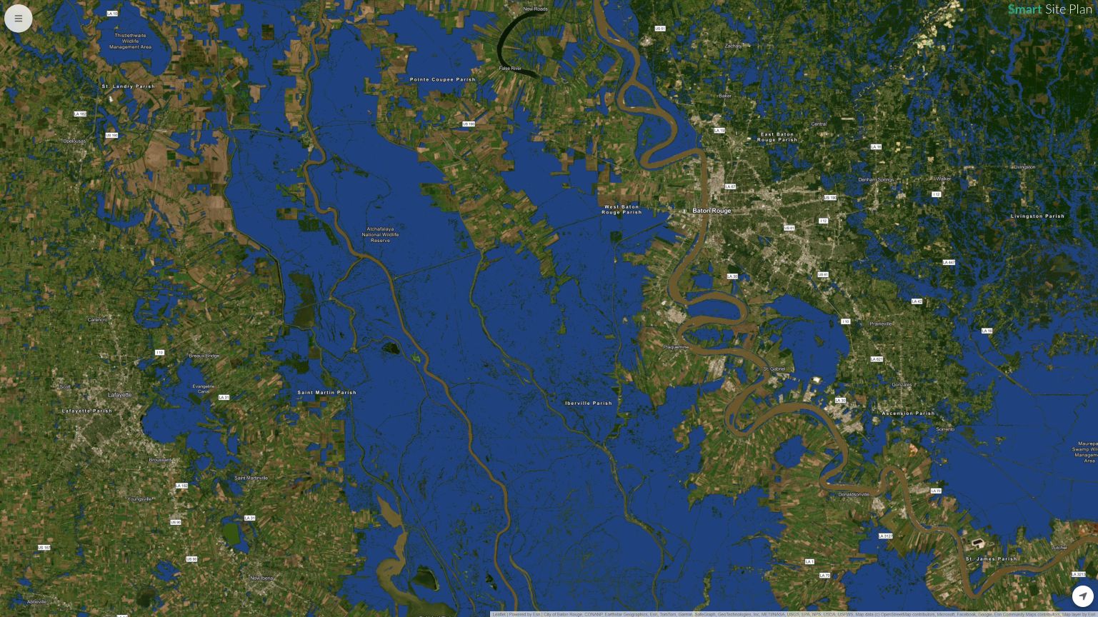
A wetland map is a spatial representation of areas where water, soil, and vegetation interact to create wetland habitat. These maps are used in environmental planning, conservation, and regulatory review to identify wetlands and deepwater habitats across a landscape.
In the United States, many of these datasets come from the U.S. Fish and Wildlife Service's National Wetlands Inventory (NWI), a widely used resource for understanding wetland location and extent.
According to the U.S. Fish and Wildlife Service, wetlands provide essential ecosystem services like flood control, wildlife habitat, and water filtration, making accurate mapping critical for land use decisions.
Wetlands are found in a wide range of environments, including floodplains, coastal zones, near lakes and streams, and in low-lying areas where water collects. However, they aren't always obvious on site.
A wetland may appear as a grassy area or seasonal waterbody, which is why planners rely on digital wetland mapping and GIS data layers to determine potential wetland presence before development begins.
Key elements often included in wetland maps:
- Boundary and classification information
- Soil and hydrology indicators
- Habitat and wildlife data
- Environmental protection status
- Approximate extent and spatial data
These maps are an essential planning resource for anyone working across infrastructure, conservation, or development. They provide a starting point for understanding environmental constraints, identifying protected areas, and determining next steps in project planning.
How do I find out if there are wetlands on my property?
You can get a preliminary wetlands overview using tools like Smart Site Plan, which aggregates over 20 million data points including the U.S. Fish and Wildlife Service Wetlands Mapper. For legal certainty, an on-site delineation by a licensed professional is still required.
Wetland Delineation, Permits, and Regulatory Planning
Wetland delineation is the process of determining the exact boundary and classification of wetlands through field assessment, soil analysis, and hydrology review.
In the U.S., many projects require coordination with agencies such as the U.S. Army Corps of Engineers or state environmental departments before construction begins. According to the Environmental Protection Agency, activities that impact wetlands often require permits under the Clean Water Act, particularly Section 404, which regulates dredge and fill activities.
Early wetland assessment helps teams:
- Determine regulatory status and permit needs
- Avoid delays and redesign
- Protect natural resources
- Maintain compliance with environmental protection standards
- Generate accurate project documentation
For local government and planning departments, wetland mapping and delineation support responsible land management and conservation goals. For contractors and developers, they help avoid costly errors and improve project timelines.
Accurate assessment information ensures that environmental and regulatory considerations are addressed early in the planning process.
What is the 50/20 rule for wetland delineation?
It is an informal reference to a vegetation dominance guideline used in some wetland delineation methods: if more than half of the dominant plant species (by cover) are obligate or facultative wetland species, the community may be considered hydrophytic.
Government Wetland Mapping Tools, Data Sources, and Disclaimers
Many professionals begin with publicly available tools like the U.S. Fish and Wildlife Service's Wetlands Mapper, an online viewer that provides access to National Wetlands Inventory data layers. These tools allow users to view wetlands, streams, lakes, and other water features across the landscape.
Public wetland mapping platforms are valuable resources, but they come with limitations. Data may be updated periodically, and boundaries are often approximate. Most government agencies include a disclaimer stating that maps should not be used as a substitute for on-site delineation or regulatory determination.
Common data sources for wetland maps:
- National Wetlands Inventory
- State environmental departments
- Local government GIS portals
- Conservation and wildlife service data
- Soil and hydrology datasets
These datasets help promote the understanding and conservation of wetlands and natural communities. However, users often need to combine multiple sources to generate a complete picture of site conditions. In many cases, planners must contact agencies, review permit requirements, and verify conditions in the field.
Challenges With Traditional Wetland Mappers and Data Access
Traditional wetland mapping workflows often rely on desktop GIS, static PDFs, and separate data layers stored across different systems. This can create gaps in communication and slow down decision-making. Field teams may not have access to the same information as office staff, leading to errors or outdated data.
Common challenges include:
- Limited real-time updates
- Difficulty sharing maps across teams
- Version control issues
- Separate systems for GIS, CAD, and reporting
- Delays in accessing current information
For government agencies and project managers, maintaining accurate wetland inventory data and keeping teams aligned can be time-consuming. Updating maps, refreshing datasets, and generating reports often requires multiple tools and manual coordination.
Modern planning increasingly depends on geospatial platforms that integrate data layers, allow digital collaboration, and provide real-time updates. These tools help managers, planners, and field staff work from a shared source of truth, reducing errors and improving environmental protection and project outcomes.
Can I view wetlands on Google Earth?
You can overlay wetland data in Google Earth, but it requires adding third-party data sources manually and is only a rough guide. For a more reliable workflow, Smart Site Plan is the better choice with wetland layers built in, so there's no need to source or import external data. Always confirm findings with official maps or a field delineation before making planning decisions.
A Smarter Way to Work With Wetland Maps: Juno Maps Smart Site Plan
Today's projects require faster access to reliable data and information. Juno Maps' Smart Site Plan software helps bring wetland maps, GIS data, and site plans into one centralized, digital platform. Instead of relying on static viewers or disconnected systems, teams can access geospatial data layers, including wetlands, from any internet-capable device.
With Smart Site Plan, users can:
- View wetland layers alongside parcels, utilities, and infrastructure
- Access the National Wetlands Inventory and other open data sources
- Conduct field assessments and add notes in real time
- Generate reports and maintain project summaries
- Share updates across teams instantly
The platform supports planners, contractors, and local government agencies by making wetland mapping more accessible and actionable. Real-time collaboration helps teams stay aligned, while centralized data improves accuracy and reduces rework.
By combining open data integration with mobile-ready workflows, Smart Site Plan helps modern teams make informed decisions faster. Whether reviewing a landscape for environmental constraints or preparing for a permit application, having current wetland data in one place supports smarter planning and better outcomes.
Why Wetland Maps Belong in Every Modern Plan
Wetland maps are more than just environmental overlays. They are essential planning tools that help protect natural resources, support compliance, and guide responsible development. From early assessment to final design, understanding wetland location, extent, and regulatory status can prevent delays and improve decision-making.
As geospatial technology evolves, accessing accurate wetland data is becoming easier and more collaborative. Digital tools like Smart Site Plan help bridge the gap between office and field, giving teams the current information they need to plan, build, and maintain projects more intelligently.
Explore how real-time wetland mapping and integrated data layers can support smarter site planning and better project outcomes. Contact us to find out more!
Ready to put this into practice?
See how Juno Maps applies to your specific industry and use case.