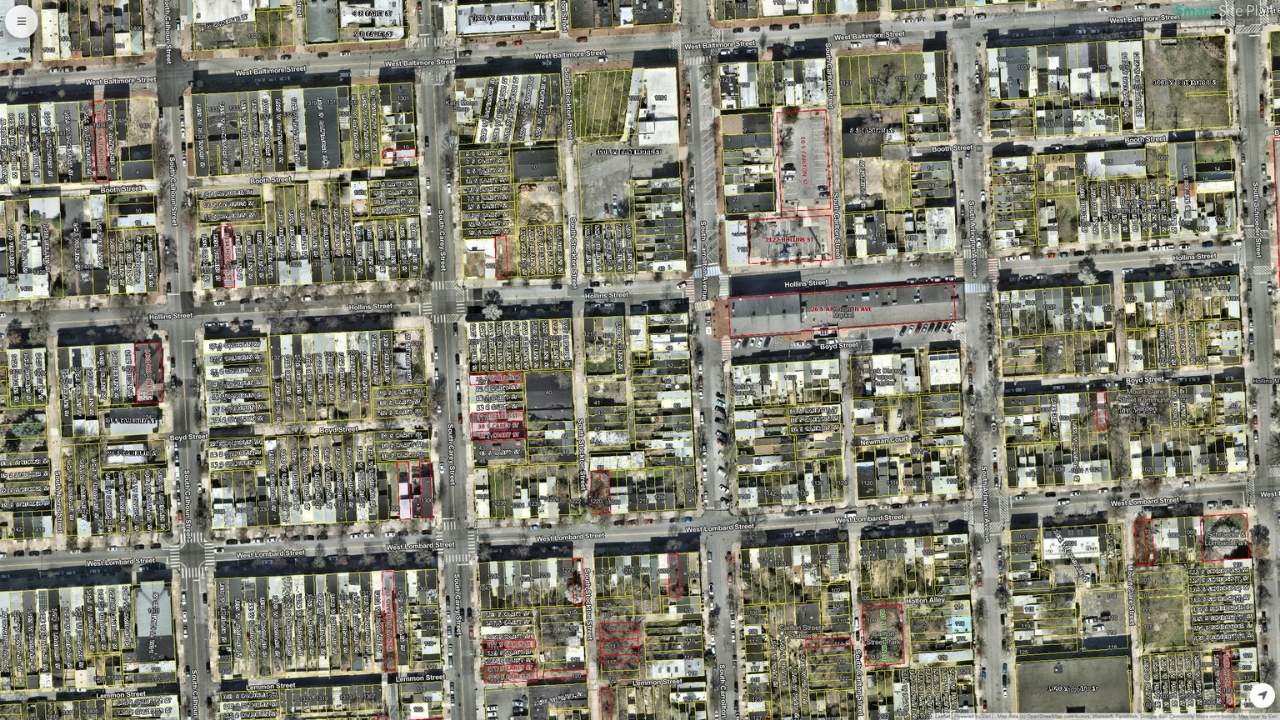
Design, build, respond, and maintain with better data.
Smart Site Plan gives you the tools to research properties, plan projects, manage construction, and coordinate disaster response. 20M+ datasets, interactive layers, and real-time collaboration on any device.
20M+
Open datasets
50+
Data categories
7
Industries served
99.9%
Uptime
Save time. Save money. Save lives.
Bring the office to the field, avoid costly mistakes, and give crews the information they need to protect communities.
Save time
Access plans, data layers, and imagery from any device instead of flipping through plan sets. During disaster response, coordinate debris operations in real time instead of chasing paper forms.
Save money
Avoid costly mistakes with accurate utility positioning and data overlays. Optimize haul routes, reduce fleet downtime, and generate audit-ready documentation that supports FEMA reimbursements and grant applications.
Save lives
Better-informed crews are safer crews. From utility awareness during construction to disaster imagery for rapid damage assessment, Smart Site Plan gives teams the information they need to respond faster.
Everything you need to work smarter.
From open data access to AI predictions, Smart Site Plan gives you the tools to research, design, manage, and respond with confidence.
Open Data
Access 20M+ geographic datasets from around the world. Browse the search engine and add as many sources as you need to a project.
Interactive Layers
Upload and edit CAD and GIS data interactively. Make design changes, create features, and collaborate from any device.
Smart Query
Instantly identify and download properties of interest. Use findings to study, share, and build with your project team.
Property Data
Access property records across the United States. Visualize lot boundaries and detailed ownership records instantly.
AI Predictions
Machine learning finds better results so you spend more time discovering. AI surfaces the insights you would otherwise miss.
Files & Storage
Store project documents and photos for quick reference wherever you are. Download for offline viewing anytime.
Smart Forms
Turn paper and PDF forms into digital workflows. Fill out RFIs, inspection reports, damage assessments, and resource requests in the field with geotagged data and photos.
Team Collaboration
Share plans via read-only links that anyone can view without an account. Track changes and maintain accountability across every project.
Data Overlays
Layer multiple data sources visually on one map. See the full picture with overlay capabilities that bring context to every project.
Purpose-built for emergency management.
Coordinate debris operations from assessment through disposal. Map debris, plan routes, track fleets, generate load tickets, and collaborate across agencies — all from one platform.
PDF Exhibit Creation
Generate professional PDF exhibits directly from the map with live preview. Customize title blocks, paper size, scale, legend, logos, and map rotation.
Route Planning
Map haul routes connecting collection areas and management sites. Create interactive routes, then save, edit, and share them with your team.
Debris Management
Delineate debris piles on the map with area and perimeter calculations. Annotate with type, handling priority, and access limitations.
Debris Load Tickets
Generate electronic load tickets from the field with customizable forms aligned to local, state, and federal standards. Time, date, and GPS captured automatically.
Fleet & Asset Tracking
Track vehicles and assets in real time for debris removal coordination. Overview of locations, assignments, and operational status across the fleet.
Field Devices
Preconfigured iPads with MDM, rugged cases, and 5G data plans. Custom home screens with support contact so teams are ready on day one.
Built for every industry.
From owners and contractors to government agencies and emergency managers, Smart Site Plan adapts to the workflow.
Owners
Property owners and developers who need visibility across the full project lifecycle.
Contractors
General contractors reducing rework and coordinating field crews without paper plan sets.
Designers
Engineers and architects reviewing design files against live site conditions.
Real Estate
Brokerages and developers running property analyses with ownership and asset records.
Education
Students and faculty learning professional GIS workflows with real open datasets.
Government
Agencies, planning commissions, and public works maintaining authoritative records.
Emergency Management
Emergency managers coordinating debris operations and damage assessment with FEMA-aligned documentation.
What makes it different.
Other platforms give you maps. Smart Site Plan gives you the data, tools, and workflows to actually get work done.
20M+ Open Datasets
The largest open geographic data search engine available. Other platforms give you a handful of base layers; Smart Site Plan gives you 20 million datasets across 50+ categories.
CAD, GIS & field data in one place
Upload CAD files, GIS data, shapefiles, drone imagery, and PDFs as interactive layers. No format conversions, no separate tools. Everything lives on one map.
Built for disaster response
Most mapping tools stop at property research. Smart Site Plan goes further with debris management, fleet tracking, electronic load tickets, and FEMA-aligned digital forms.
Field-ready on any device
No app to download. Works on desktop, tablet, and phone in any browser. Preconfigured iPads with rugged cases, MDM, and 5G also available for teams in the field.
Share without the risk
Share project maps via read-only links that anyone can view without creating an account. Stakeholders, partners, and the public see exactly what you want them to see.
Real support, real people
Call, text, or email. Every plan includes support from people who know the platform. Custom plans come with dedicated onboarding and training for your team.
Trusted by government agencies, planning commissions, and disaster response organizations.
Recognized in the RISE Riverine program for resilience innovation. Partnered with Planning District Commissions for geospatial data management. Forms and documentation workflows aligned to federal, state, and local debris management standards.
Simple, transparent pricing.
Choose the plan that fits. Team plan includes a 7-day free trial. Civic is free for verified government officials.
Civic
For government officials with a .gov email.
- Open data access
- AI predictions
- Download data
- Layers & overlays
- PDF exports
- Smart Query
- Property data
Pro
For individual professionals.
- Everything in Civic
- Files, Forms & PDF Export
- 1 GB storage
- Billed monthly or yearly
Team
For teams and small businesses.
- Everything in Pro
- Property Data (200/mo)
- Up to 5 users · 5 projects
- 5 GB storage
- Route Planning & Sharing
- Team Collaboration
Custom
For enterprises and emergency operations.
- Everything in Team
- Debris Management Suite
- Fleet & Asset Tracking
- Electronic Load Tickets
- Field Devices & 5G Plans
- Unlimited users & projects
- Dedicated support
All plans include SSL encryption, 99.9% uptime, and access from any device.
Enterprise controls. No exceptions.
Passkey and WebAuthn authentication, two-factor authentication, SSL-encrypted connections, and 99.9% uptime. Read-only share links let you collaborate with stakeholders without requiring accounts.
Ready to get started?
Join the professionals who rely on Smart Site Plan every day. Start your free 7-day trial and see what it can do for your team. No credit card required.