
Water Line Maps 2026: Smart Strategies for Reliable Water
Water line maps are living records that help public agencies protect drinking water, plan infrastructure investments, and respond quickly when something goes wrong. As regulatory requirements grow and communities demand transparency, accurate water line maps have become essential public information.
Water line maps are more than technical drawings: they are living records that help public agencies protect drinking water, plan infrastructure investments, and respond quickly when something goes wrong. As regulatory requirements grow and communities demand transparency, accurate water line maps have become essential public information. A water line map is a visual record of a community's drinking water distribution system, showing the location, type, and connections of water lines from treatment facilities to properties across a service area.
Key Takeaways
- Water line mapping has evolved from paper records and static drawings to connected, digital systems updated and shared across teams
- Water line maps use standardized symbols and line types to display the physical layout of a drinking water distribution system
- Identifying service lines and determining ownership responsibility is a key task for inspections, replacement programs, and customer communication
- Viewing water and sewer lines together helps crews avoid conflicts during excavation and supports safer construction practices
- Modern water line maps are GIS-based, combining hydraulic data, parcel and address information, and infrastructure attributes to understand system-wide impacts
- EPA's Lead and Copper Rule Improvements require utilities to develop and maintain a service line inventory updated annually
- Connecting historical records with field verification helps agencies identify potential lead service lines and plan replacement programs; see EPA guidance on emergency preparedness
- Complete, field-verified asset inventories are now required for LCRR and EPA compliance programs
What Is a Water Line Map?
These maps typically include:
- Water mains and distribution lines
- Service lines connecting mains to individual properties
- Valves, hydrants, meters, and related utility assets
- Attributes such as service line material, installation era, and ownership
For water districts and counties, a water line map serves as both an operational tool and an official record used for planning, inspections, and regulatory reporting.
How can I find out where my water pipe runs?
Start by contacting your local water district or utility. They can help locate the public service line and explain what information is available for your property.
Why Water Line Maps Matter for Public Agencies
Water line maps support:
- Drinking water protection and public health oversight
- Compliance with Environmental Protection Agency requirements
- Coordination across water and sewer utilities
- Transparency for customers and property owners
Federal agencies such as the Environmental Protection Agency emphasize accurate system inventories as a foundation for reducing lead exposure and protecting drinking water.
Water Line Mapping and Modern Infrastructure Management
Water line mapping has evolved significantly as communities face aging infrastructure, tighter regulatory requirements, and growing expectations for transparency. What was once managed through paper records and static drawings is now handled through connected, digital systems that support daily operations and long-term planning.
What Water Line Mapping Looks Like Today
Many water districts are moving away from paper files and static PDFs toward digital mapping that can be updated and shared across teams. Modern water line mapping typically lives within a centralized data system that allows agencies to:
- View and maintain water line maps in one place
- Update records as inspections, repairs, or replacements occur
- Link the line location with the service line material and asset condition
This approach supports compliance with federal requirements such as the EPA’s Lead and Copper Rule Revisions, which require utilities to develop and maintain a service line inventory and update it annually. By connecting historical records with field verification, agencies can better identify potential lead service lines and plan replacement programs more effectively.
The Role of GIS in Water Line Mapping
Geographic Information Systems, or GIS, provide the spatial accuracy that modern water line mapping depends on.
GIS allows utilities to:
- Locate water lines precisely in the field
- View infrastructure in relation to parcels, addresses, and rights-of-way
- Understand how water, sewer, and other utilities interact underground
The United States Geological Survey emphasizes the importance of spatial data for understanding how water infrastructure functions within its broader physical and environmental context. Together, GIS and centralized data systems help agencies manage water infrastructure more safely, accurately, and efficiently.
Who is responsible for the service line?
Responsibility depends on the district and location. Many utilities own the line to the property boundary, while the private service line beyond that point belongs to the customer.
How to Read a Water Line Map
Reading a water line map does not require deep GIS expertise, but it does require understanding how water infrastructure is represented and how data is layered to support safe decisions. When used correctly, these maps help public agencies locate assets, verify responsibility, and reduce risk during planning, maintenance, and construction.
Understanding Lines, Symbols, and Service Connections
Water line maps use standardized symbols and line types to display the physical layout of a drinking water distribution system.
Most maps include:
- Main lines and service lines, shown with different line weights or colors
- Valves, hydrants, and meters, marked with common utility symbols
- Attributes, such as pipe size, installation era, or service line material
A key task is identifying service lines and determining ownership responsibility. This distinction matters for inspections, replacement programs, and customer communication.
Water line maps are also read in context with surrounding utilities. Viewing water and sewer lines together helps crews avoid conflicts during excavation and supports safer construction practices, a long‑standing best practice in utility and infrastructure planning.
Using Data Layers to Understand What’s Happening Underground
Modern water line maps are GIS-based and rely on layered data to provide clarity.
Layered views allow users to:
- Highlight potential lead service lines
- Display inspection or replacement status
- Separate water, sewer, and other utility systems
Combining hydraulic data, parcel and address information, and infrastructure attributes helps agencies understand how an issue in one location may affect the broader distribution system. GIS standards have made this layered approach a best practice across water districts.
To avoid misinterpretation, agencies are encouraged to clearly label data based on historical records and verify conditions through field inspection when possible. District-level efforts show how maintaining web-accessible, regularly updated maps improves coordination and supports safe, informed decision-making.
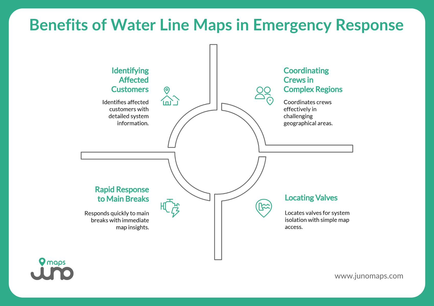
Water Line Maps in Emergency Response and Recovery
When a water main breaks or service is disrupted, accurate water line maps become an essential operational resource. In emergency situations, clear mapping helps utilities respond faster, communicate better, and protect both infrastructure and public health.
Responding Faster to Main Breaks, Leaks, and Service Disruptions
Water line maps allow agencies to quickly identify what is affected and where action is needed.
With real-time map access, teams can:
- Identify affected areas and customers
- Determine whether public or private service lines are involved
- Locate valves and isolate sections of the system
EPA guidance on emergency preparedness and source water protection stresses having current system information and clear procedures available when incidents occur, so utilities can make rapid, well‑informed decisions.
Web-based map viewers help coordinate crews by giving field staff and supervisors a shared view of the system. This reduces response time, limits confusion, and supports safer work in complex service areas, including large valley regions or multi-jurisdictional districts.
Supporting Post-Event Documentation and Recovery
After service is restored, water line maps support recovery and future planning.
Agencies use maps to:
- Document damage, repairs, and materials used
- Store photos and notes linked to specific locations
- Review historical events to improve future response
When this information is archived in a centralized, web-accessible system, it becomes a reliable resource for internal review, public communication, and long-term infrastructure improvement.
Making Water Line Mapping Practical with Smart Site Plan
Managing water infrastructure requires tools that reflect how work actually happens in the field and in the office. Smart Site Plan, developed by Juno Maps, is designed to support water line mapping by making existing data easier to access, share, and maintain, without replacing the systems communities already rely on.
Bringing Water Line Maps into One Connected Platform
Water districts and public agencies often manage water line information across multiple formats and sources. Smart Site Plan acts as a central viewing and collaboration platform, bringing those files together in one place.
With Smart Site Plan, agencies can:
- Upload CAD, GIS, PDFs, and legacy files related to water infrastructure
- View water line maps alongside other project documents
- Maintain a single, shared source for map-based information
Rather than creating new authoritative records, the platform helps teams work with existing source data more effectively, supporting transparency and consistency across departments.
Because Smart Site Plan is web-based, water line maps can be viewed on any internet-capable device. This allows staff to access current information in the office, at a job site, or during an inspection, without specialized software or a complex setup.
Can I see water line information online?
Some water districts provide map viewers or online resources, especially for lead service line information. Availability varies by area.
Why Communities Choose Smart Site Plan from Juno Maps
One of the most common challenges in water line mapping is usability. Many GIS tools require technical expertise that limits who can view or interact with maps.
Smart Site Plan is intentionally designed for non-technical users, allowing planners, inspectors, contractors, and decision-makers to:
- View georeferenced maps without GIS training
- Add notes, markups, and comments in real time
- Collaborate across teams using shared map views
The platform supports real-world planning, maintenance, and emergency use by focusing on map access and communication, rather than advanced analysis. This makes it especially useful during time-sensitive situations when teams need clear information quickly.
By focusing on access, collaboration, and real-time awareness, Smart Site Plan helps public agencies manage water infrastructure with greater clarity and confidence, while respecting existing data sources and responsibilities.
Clear Information Builds Stronger Water Systems
Strong water systems are built on clear information. When teams can easily see, understand, and discuss what lies underground, they are better equipped to plan wisely, respond quickly, and protect public health.
Smart water line mapping is not about replacing existing systems. It is about connecting people to the information they already have in a way that supports safer, smarter decisions.
To see how a shared, web-based mapping platform can support your water infrastructure goals, get in touch. Learn more about Smart Site Plan today.
Ready to Put This Into Practice?
See how Juno Maps applies to your specific industry and use case.