Sewer Line Map: Advanced GIS Tools for Public Works in 2025
Sewer infrastructure is one of the most essential public services a city provides, yet it is also one of the least visible. When cities rely on incomplete or outdated sewer line maps, small issues turn into costly failures.
Sewer infrastructure is one of the most essential public services a city provides, yet it is also one of the least visible. Most sewer pipes, main sewer lines, and service connections run underground, out of sight and often out of mind, until something goes wrong. When cities rely on incomplete or outdated sewer line maps, small issues turn into costly failures. City sewer line maps provide a geographic record of how wastewater moves through a community. They document the location, connectivity, and attributes of sewer pipes that serve homes, businesses, and public facilities.
Key Takeaways
- Sewer line maps are most powerful when used to identify patterns, not just locations, combining pipe attributes, inspection data, and service history to spot early indicators of failure
- The EPA CMOM framework and ASCE infrastructure guidance both emphasize condition assessment and data-driven prioritization as essential to reducing sewer system risk
- Field access to sewer line maps is essential for safety, accuracy, and efficiency: OSHA stresses the importance of knowing underground utility locations before excavation
- GIS-based sewer maps enable analysis of pipe age, material, and condition to identify high-risk segments; overlay with parcels, flood zones, and land use to assess vulnerability
- Traditional GIS systems are often limited to office environments and technical users, creating a gap between the GIS record and what is happening in the field
- Smart Site Plan enables real-time collaboration: teams can mark up sewer maps in the field, sync updates instantly, search assets faster, and capture inspection data with mobile-ready forms
- Digital sewer maps eliminate reliance on paper as-builts that are rarely updated after construction
Why City Sewer Line Maps Matter for Risk Reduction
Federal agencies such as the U.S. Environmental Protection Agency (EPA) have consistently emphasized that proactive sewer system management reduces sanitary sewer overflows, basement backups, and regulatory violations. The EPA’s Capacity, Management, Operation, and Maintenance (CMOM) framework specifically identifies system mapping and data management as foundational to reducing risk and improving compliance under the Clean Water Act (33 U.S.C. §1251 et seq.).
Without accurate city sewer line maps, utilities face:
- Increased emergency repairs and overtime costs
- Higher risk of sewer overflows and environmental violations
- Slower response times during service disruptions
- Greater exposure to public complaints and liability
Sewer line maps allow cities to move from reactive maintenance to preventive risk management by understanding where vulnerabilities exist before failures occur.
What is a sewer line map?
A sewer line map shows the location of sewer pipes, main sewer lines, and service connections that carry wastewater from homes and businesses to the sewer system.
What a Map of Sewer Lines Typically Includes
A modern map of sewer lines is more than a simple diagram. It is a structured record of sewer system assets tied to real-world location and operational detail.
Common elements include:
- Sewer pipe locations and alignments
- Pipe diameter, material, and installation date
- Main sewer lines and lateral service connections to houses
- Manholes, cleanouts, and access points
- Flow direction and system hierarchy
- Inspection, maintenance, and repair history
This information is critical for locating assets during maintenance, coordinating with other utilities, and avoiding damage during excavation. Context also matters. Sewer pipes rarely exist alone. They intersect with roads, parcels, water lines, storm drains, and private property. Without that broader geographic context, even accurate sewer data can lead to errors in the field.
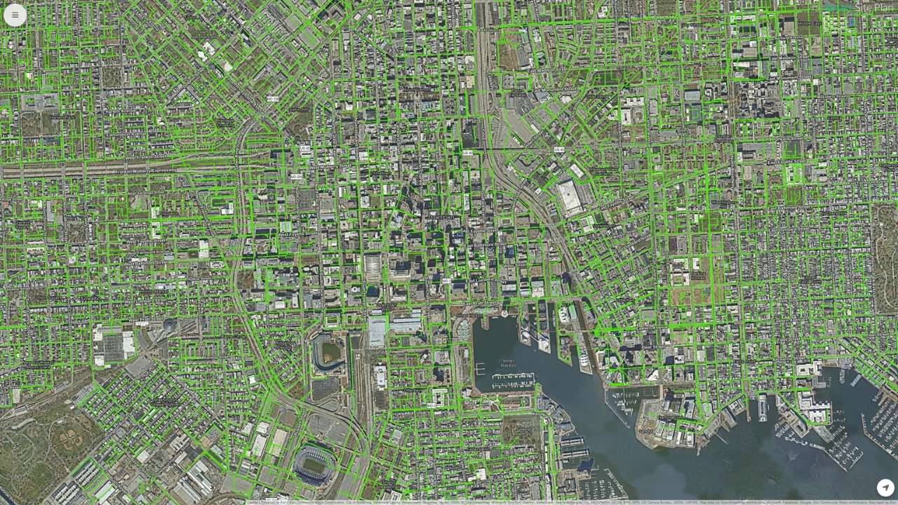
Interactive Map – Map of Baltimore Sewer Mains – View Full Map
Sewer Line Maps as Early Warning Systems
Sewer line maps are most powerful when they are used to identify patterns, not just locations. By combining pipe attributes, inspection data, and service history, utilities can spot early indicators of failure.
Examples include:
- Older sewer pipes made of materials prone to corrosion
- Repeated blockages in the same service area
- Capacity constraints during wet weather
- Sewer mains located in high-risk flood zones
The EPA CMOM framework and American Society of Civil Engineers (ASCE) infrastructure guidance both emphasize that condition assessment and data-driven prioritization are essential to reducing sewer system risk. Mapping allows utilities to see where issues are likely to occur and intervene before service is disrupted.
Preventive planning reduces:
- Emergency call-outs
- Sewer overflows and backups into homes
- Environmental damage to surface waters
- Public health risks associated with wastewater exposure
City Sewer Line Maps in the Field
Risk reduction does not happen only in the office. It happens where crews work, inspect, and repair infrastructure. Field access to sewer line maps is essential for safety, accuracy, and efficiency.
When field teams can locate sewer pipes accurately:
- Excavation risks are reduced
- Crews avoid damaging water and sewer utilities
- Repairs are completed faster and with fewer errors
The Occupational Safety and Health Administration (OSHA) consistently stresses the importance of knowing underground utility locations before excavation. Mobile access to sewer line maps ensures that crews are working with current information, not printed plans that may be outdated.
Field teams also generate valuable data. Photos, condition notes, and inspection results captured on site help keep sewer maps current and reliable.
Can I find a sewer line map for my house?
In many cities, you can view a sewer line map for your house through a public GIS or utility map. Availability varies, and private sewer lines may not always be shown.
What Communities Should Expect from Modern, GIS-Based Sewer Line Mapping
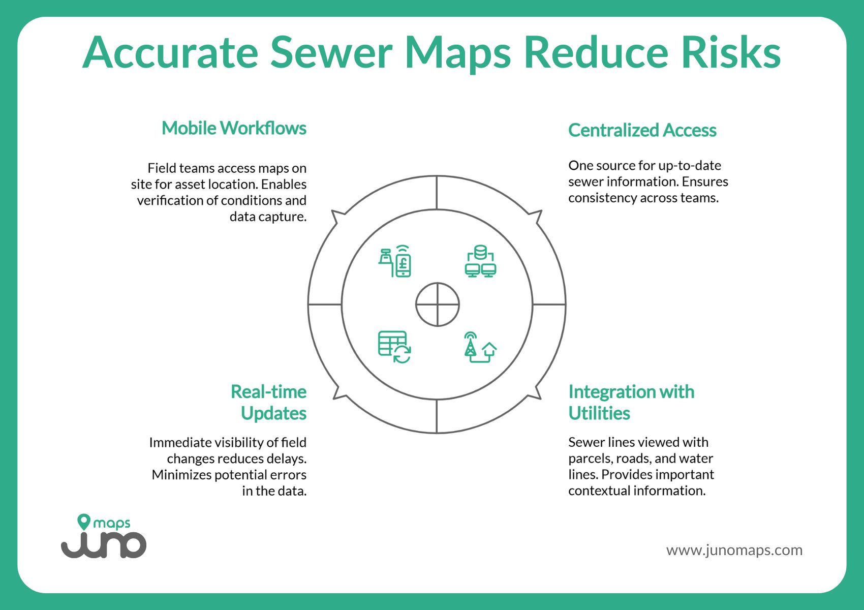
Modern sewer line mapping should help cities reduce risk, not manage paperwork. To support proactive maintenance and safer operations, sewer data must be accessible, current, and connected to how teams work in the field and the office.
At a technical level, modern sewer line maps are built and maintained as GIS (Geographic Information System) sewer line maps. GIS provides the framework that allows sewer infrastructure to be stored as spatially accurate features, connected to attribute data, and analyzed over time. For cities and utilities, GIS is the system of record that turns raw utility data into a usable, location-based asset inventory.
At a minimum, modern sewer mapping should include:
- Centralized access to sewerdata: One authoritative source so all teams work from the same, up-to-date information.
- Integration with parcels, roads, and other utilities: Context matters. Sewer lines need to be viewed alongside parcels, streets, water lines, and other infrastructure.
- Real-time updates and collaboration: Changes in the field should be visible immediately, reducing delays and errors.
- Mobile-ready workflows for field teams: Crews need access to sewer maps on site to locate assets, verify conditions, and capture accurate data.
Moving Beyond Static Sewer Maps
Paper plans and disconnected files introduce uncertainty. They are hard to update, difficult to share, and often out of date.
Static sewer maps increase risk because:
- Field crews may work with incomplete information
- Emergency response is slowed
- Maintenance decisions rely on assumptions instead of current data
Modern sewer line mapping replaces static records with shared, living data, helping communities spot issues earlier and respond with confidence.
Why GIS Sewer Line Maps Matter for Risk Reduction
GIS enables utilities to move beyond simple visualization. With GIS-based sewer line maps, cities can:
- Analyze pipe age, material, and condition to identify high-risk segments
- Overlay sewer data with parcels, flood zones, and land use to assess vulnerability
- Track inspection and maintenance history spatially
- Support asset management and capital improvement planning
However, traditional GIS systems are often limited to office environments and technical users. This creates a gap between the GIS record and what is happening in the field, where many risks are first identified.
Bridging GIS Standards with Field-Ready Workflows
The most effective sewer mapping programs preserve GIS standards while making data usable beyond the GIS department. This means keeping authoritative GIS data intact while enabling:
- Mobile access for field teams
- Real-time updates tied to location
- Cross-department visibility into sewer system data
Smart Site Plan is designed to work within this reality. It builds on GIS principles and data structures while extending access to non-technical users, ensuring that sewer line maps remain accurate, current, and operationally relevant.
Where does sewer line map data come from?
Sewer line map data is typically maintained by city or utility departments using construction records, inspections, and GIS systems.
How Juno Maps Helps Cities See Problems Before They Happen
Reducing sewer system risk starts with better visibility. Juno Maps’ Smart Site Plan brings sewer line data, GIS layers, CAD files, and project documents into one shared geospatial environment, so teams are no longer working from disconnected systems or outdated plans.
Instead of treating sewer line maps as static references, Smart Site Plan turns them into an operational tool that supports planning, inspections, and maintenance.
Smart Site Plan helps cities:
- View citysewer line maps in context: See sewer lines alongside parcels, roads, and water infrastructure in one georeferenced map view.
- Accesssewer systemdata anywhere: Work from any internet-capable device without relying on paper plans or desktop software.
- Collaborate in real time: Mark up sewer maps in the field and sync updates instantly across teams.
- Find assets faster with smart search: Quickly locate sewer lines, pipes, parcels, and utilities when time matters.
- Capture inspection data on site: Use mobile-ready forms to record notes and photos directly in the field.
By combining centralized access, real-time collaboration, and mobile workflows, Smart Site Plan helps cities reduce uncertainty, improve coordination, and address sewer system issues before they escalate.
From Hidden Risk to Visible Control with Smart Site Plan
Sewer systems may be underground, but the risks they pose are very real. Accurate, accessible sewer line maps give cities the visibility they need to protect public health, safeguard the environment, and deliver reliable service.
When sewer mapping is treated as critical infrastructure data and supported by modern geospatial tools, communities move from reactive repairs to proactive risk reduction. Platforms like Smart Site Plan make that shift possible by connecting data, people, and location in one shared environment.
To see how your city can modernize sewer line mapping and reduce risk before problems happen, learn more about Smart Site Plan.
Ready to Put This Into Practice?
See how Juno Maps applies to your specific industry and use case.