Parcel Maps: 5 Critical Insights for Local Governments
Parcel maps are far more than background reference tools. For counties, municipalities, and local agencies, parcel data is one of the most critical layers of geographic information used to plan land use, maintain infrastructure, respond to emergencies, and serve the public.
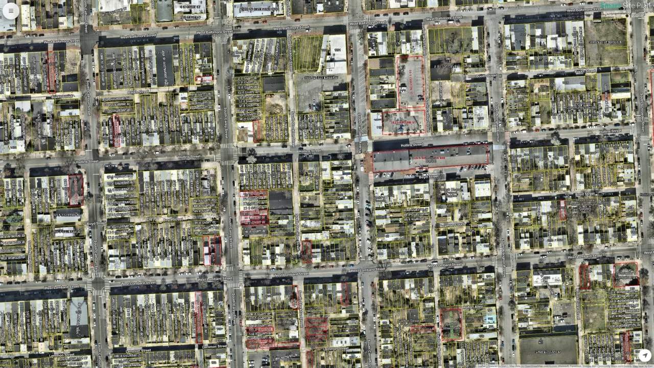
Parcel maps are often treated as background reference tools: something to look up when a question comes up about property lines, ownership, or taxes. But for counties, municipalities, and local agencies, parcel data is far more than that. It is one of the most critical layers of geographic information used to plan land use, maintain infrastructure, respond to emergencies, and serve the public. When parcel maps are accurate, accessible, and connected to real-world workflows, communities make better decisions. When they are outdated, siloed, or difficult to access, small errors compound into larger risks, delays, and costs.
Key Takeaways
- Under the National Spatial Data Infrastructure (NSDI), managed by the Federal Geographic Data Committee (FGDC), cadastral/parcel data is a core framework layer supporting land management, environmental protection, emergency response, and economic development
- A GIS parcel map links every parcel to geographic coordinates and attributes such as address, ownership, acreage, and tax ID, enabling integration with utilities, hazards, infrastructure, and environmental data
- Parcel data is inherently dynamic: updates depend on recorded deeds, surveys, subdivisions, and assessment cycles, creating a lag between real-world changes and digital records
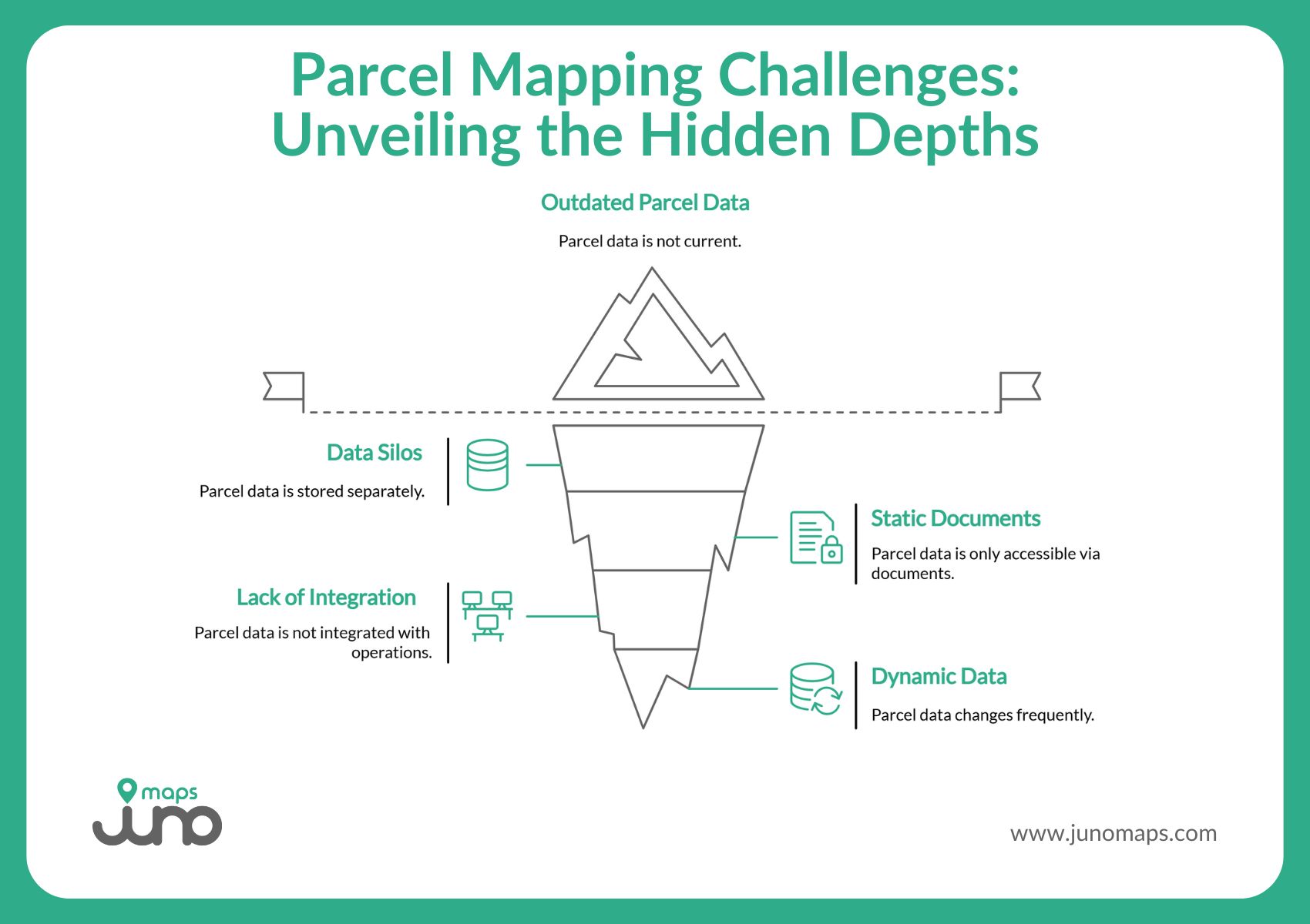
- Without reliable parcel data, departments rely on static PDFs, siloed spreadsheets, and disconnected local systems, leading to duplication, delay, lost revenue, and liability disputes
- Smart Site Plan is built for real-world users, not just GIS specialists, enabling faster onboarding, consistent field reporting with parcel-linked notes and photos, and less dependence on a small technical team
Why Parcel Maps Are Critical Infrastructure Data
- Land use, zoning, and planning decisions
- Utility maintenance and infrastructure deployment
- Inspection and permitting workflows
- Emergency response and disaster resilience planning
- Public access to land information and transparency initiatives
Under the National Spatial Data Infrastructure (NSDI), managed by the Federal Geographic Data Committee (FGDC), cadastral or parcel data are identified as a core framework layer that supports land management, environmental protection, emergency response, and economic development. This designation reflects the reality that parcel boundaries provide the common reference point needed to link geographic data with legal, administrative, and planning systems across jurisdictions.
What Does a Parcel Map Include
Parcel maps contain essential elements such as:
- Parcel boundaries (land division lines)
- Ownership information
- Address and legal identifiers
- Acreage and land use attributes
- Tax or assessment details
Because parcel maps sit at the intersection of legal, tax, planning, and geographic systems, they help ensure continuity and alignment across disparate stakeholders. Without reliable parcel data, departments often rely on static PDFs, siloed spreadsheets, and disconnected local systems, which leads to duplication, delay, and even lost revenue or liability disputes.
What is a parcel map?
A parcel map is a geographic map that shows how land is divided into individual parcels. Each parcel is linked to information such as boundaries, address, acreage, and ownership or tax records used by counties and local governments.
Parcel Mapping in the Real World: Where It Often Goes Wrong
Many local governments struggle with parcel data being:
- Out of date or in different formats
- Stored in departmental silos
- Accessible only via static documents
- Not integrated with field operations
This fragmentation affects everything from planning to emergency response. For example, when an emergency manager needs to know which parcels are in a floodplain, relying on outdated maps or PDFs causes time lags in response and risk assessment. Tools such as FEMA’s HAZUS leverage GIS technologies combined with underlying parcel and hazard data to model risk precisely, but only if the underlying data are current and accessible.
Inaccurate or inaccessible parcel data also increases the risk of liability when a public agency acts on outdated or incomplete information. Clear, accurate, and accessible parcel data help mitigate those risks by linking geographic location to verified administrative information that supports responsible governance.
GIS Parcel Map Basics for Communities
A GIS parcel map is simply a parcel layer displayed in a Geographic Information System (GIS), where every parcel is linked to a set of geographic coordinates and a set of attributes such as address, ownership, acreage, and tax ID. Integrated parcel mapping in GIS enables communities to:
- Visualize land divisions and ownership patterns
- Query parcels by attribute (e.g., address, tax ID, acreage)
- Integrate parcels with other data layers such as utilities, hazards, infrastructure, and environmental conditions
- Display parcel data via online map viewers and downloadable web services
It is important to recognize that parcel data are inherently dynamic. Updates depend on recorded deeds, surveys, subdivisions, and assessment cycles, which means there is often a lag between real-world changes and their appearance in digital parcel maps. Understanding data sources and update dates helps users interpret parcel information responsibly and avoid misapplication.
How to read a parcel map?
Start by identifying the parcel boundary and parcel ID. Then confirm the address and review nearby context like roads, utilities, or easements. Always check the data source and date to ensure the information is current.
Parcel Maps for Preparedness, Response, and Recovery
Parcel data also plays a central role in emergency planning and resilience. FEMA’s frameworks encourage integrating geospatial data, including parcel boundaries, into risk assessment and mitigation planning because accurate parcel information improves:
- Preparedness by identifying infrastructure and at-risk populations
- Response through quick field reporting and analysis
- Recovery through damage documentation and reimbursement support
Community planners and emergency managers use parcel layers combined with hazard maps, such asflood maps maintained by FEMA, to anticipate and plan for risk, assign resources, and document outcomes.
This alignment of parcel infrastructure data with hazards supports compliance with planning standards and helps communities qualify for funding and disaster recovery programs.
What Communities Should Expect from Modern Parcel Infrastructure
Modern parcel infrastructure should provide:
- Centralized access to parcel data and project files
- Real-time updates and collaboration
- Mobile-ready workflows for field teams
- Georeferenced layers for safer planning and maintenance
- Advanced search and export tools for county or statewide parcel datasets
These capabilities reduce errors, enhance accuracy, and bring field and office operations into alignment so that the same parcel data support planning, permitting, and ground truth tasks.
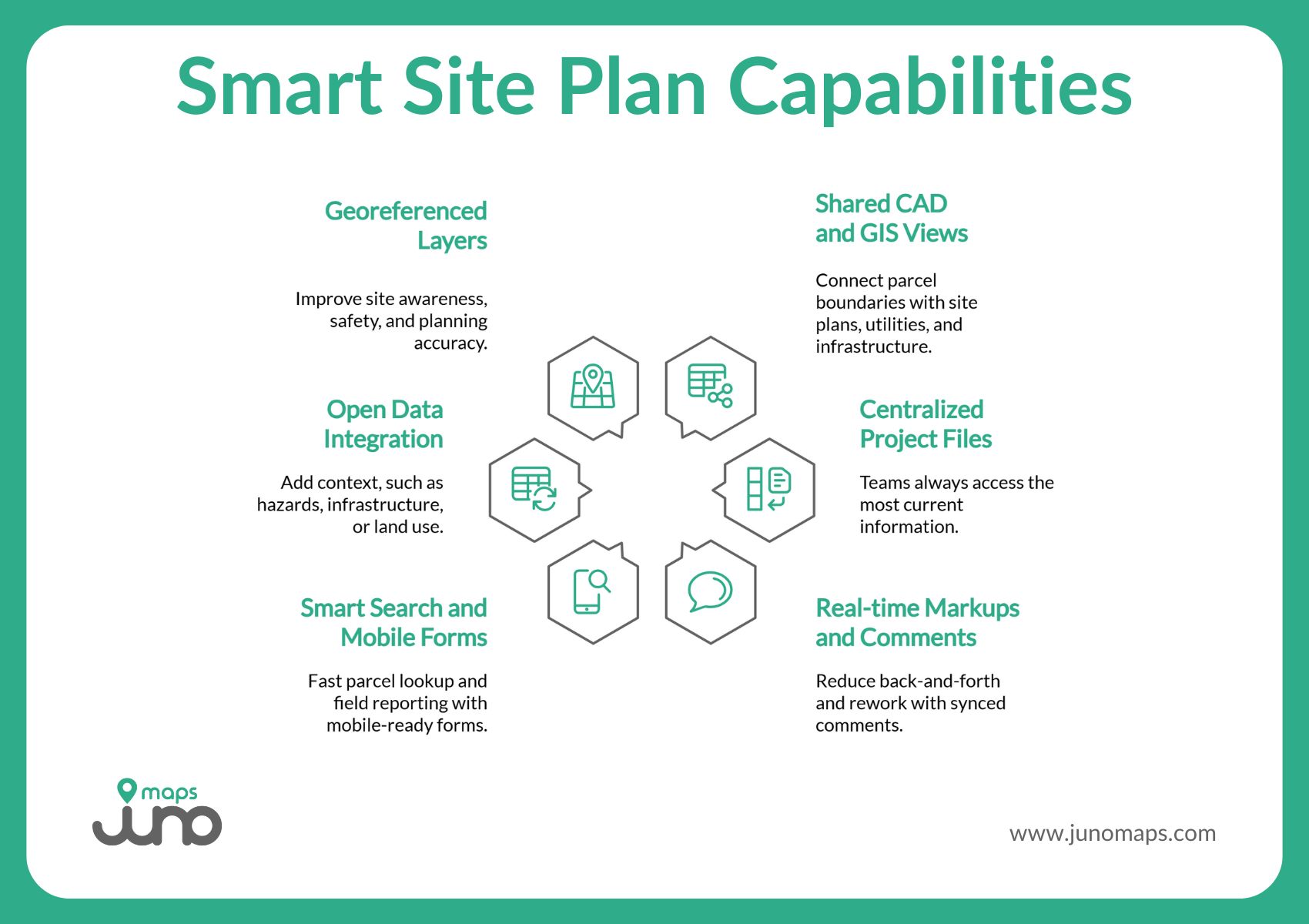
Smart Site Plan: From Static Parcel Maps to Shared, Real-Time Insight
Parcel mapping should support daily operations, not slow them down. Yet many counties and agencies still rely on systems that keep parcel data locked in desktop software, static files, or departmental silos. Smart Site Plan, developed by Juno Maps, is designed to change that.
Smart Site Plan brings parcel maps, CAD files, GIS layers, and supporting documents into a single, shared geospatial view that works in the office and the field. By making parcel-linked information accessible on any internet-capable device, the platform helps communities move from static maps to real-time, location-based decision making.
Key capabilities include:
- Shared CAD and GIS views that connect parcel boundaries with site plans, utilities, and infrastructure
- Centralized project files so teams always access the most current information
- Real-time markups and synced comments that reduce back-and-forth and rework
- Smart search and mobile-ready forms for fast parcel lookup and field reporting
- Open data integration to add context, such as hazards, infrastructure, or land use
- Georeferenced layers that improve site awareness, safety, and planning accuracy
Together, these features help agencies improve accuracy from the start, streamline workflows, and support safer, more informed work in the field.
What is a GIS parcel map?
A GIS parcel map is a parcel layer displayed in a Geographic Information System. It allows users to search, analyze, and view parcels alongside other geographic data such as zoning, infrastructure, or hazard layers.
Why “No GIS Background Required” Drives Adoption
Smart Site Plan is built for real-world users, not just GIS specialists. That design choice directly impacts adoption and results.
- Faster onboarding across departments, from planning to public works
- More consistent field reporting, with parcel-linked notes and photos captured on-site
- Less dependence on a small technical team, freeing specialists to focus on higher-value work
By lowering the barrier to entry, Smart Site Plan turns parcel data into a shared operational resource that supports smarter planning, maintenance, and response across the community.
Make Parcel Maps Work for Your Community with Juno Maps
Parcel maps are far more than flat drawings. As a critical layer of infrastructure data, they connect spatial boundaries with administrative, tax, ownership, and planning information that communities depend on to govern responsibly. Whether used for land use planning, emergency resilience, public works, or county administration, parcel data are foundational to effective decision making.
Smart Site Plan enables agencies to move beyond static parcel maps by bringing GIS, CAD, and open data into a single, field-ready platform. Discover how Smart Site Plan supports smarter parcel mapping for today’s communities. Learn more here!
Ready to Put This Into Practice?
See how Juno Maps applies to your specific industry and use case.