GIS in Government: 5 Smart Uses That Boost Efficiency
Local governments are being asked to do more with less. GIS technology turns location-based data into insights decision-makers can actually use, supporting everyday government operations from public works to emergency response.
Local governments are being asked to do more with less. More data, more transparency, faster response times, and smarter planning, often with limited staff and aging systems. At the center of this shift is GIS in government, a technology that turns location-based data into insights decision-makers can actually use. A geographic information system is no longer just a computer system that analyzes and displays geographically referenced information for GIS professionals. Today, GIS technology supports everyday government use, from public works and code enforcement to emergency response and long-term urban planning.
Key Takeaways
- Public works use GIS maps to manage roads, stormwater systems, and public infrastructure; utility departments track water, sewer, and power assets for better asset management
- Code enforcement uses GIS data to identify violations, inspection sites, and compliance trends; planning and zoning teams analyze land uses, zones, and potential development sites
- GIS supports disaster response coordination, per FEMA's Risk MAP framework, allowing agencies to track impacts, allocate resources, and share information securely across departments in real time
- Environmental monitoring with GIS data helps governments map air quality, rainfall, water resources, and environmental risk factors; the EPA and U.S. Geological Survey provide key datasets for this analysis
- GIS integration remains one of the biggest challenges: disconnected CAD files, spreadsheets, and legacy systems introduce risk and prevent a comprehensive, real-time view of conditions, per NSGIC
- A single, shared geospatial source of truth addresses fragmentation by anchoring data to location, allowing departments to work from the same information
What GIS in Government Really Means Today
What has changed is who can use GIS.
Historically, GIS software lived in specialized departments and required deep technical expertise. Today, governments need GIS tools that support planners, inspectors, field crews, emergency managers, and leadership alike. Visualization, real-time access, and ease of use now matter just as much as analytical power.
From Maps to Meaningful Decisions
Modern government GIS goes beyond static maps. It allows agencies to:
- Map and analyze spatial data across time
- Use GIS to identify trends, risks, and opportunities
- Support location-based decisions tied to zoning, assets, and services
This shift aligns with federal guidance such as FEMA’s Risk MAP framework, which emphasizes the use of geospatial data to support mitigation, preparedness, response, and recovery, not just mapping hazards after the fact.
What does GIS stand for in government?
GIS stands for Geographic Information System. In government, it refers to a computer system that collects, analyzes, and displays geographically referenced data to support planning, operations, and decision-making across local, state, and federal agencies.
GIS for Local Government Decision-Making
GIS for local government supports decisions that affect residents every day. Whether allocating resources, approving permits, or responding to emergencies, spatial context helps leaders see the full picture.
Local government agencies increasingly rely on GIS to connect maps and data across departments, reducing silos and improving accountability.
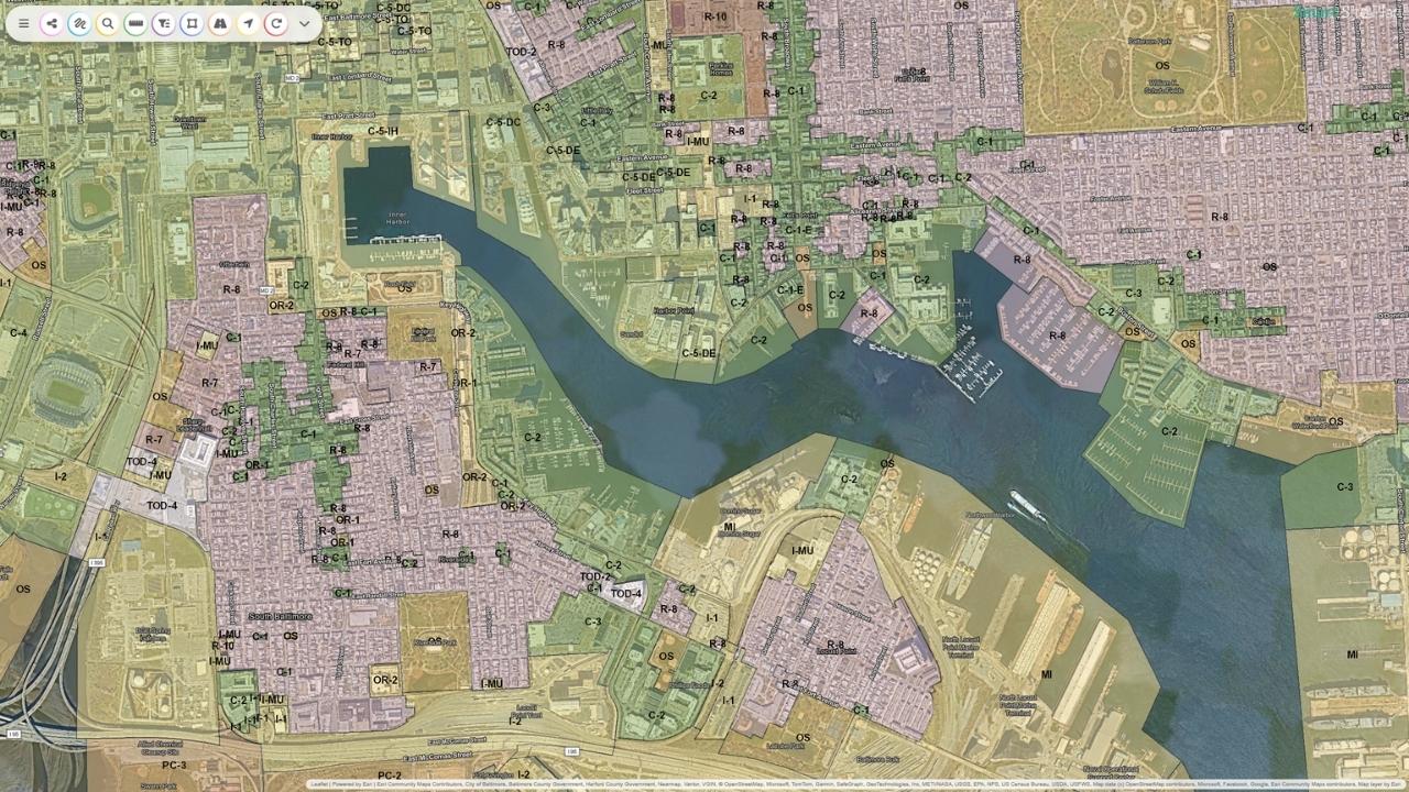
How Local Government Departments Use GIS
Across the U.S., departments can use GIS in practical, operational ways:
- Public works use GIS maps to manage roads, stormwater systems, and public infrastructure
- Utility departments track water, sewer, and power assets for better asset management
- Code enforcement uses GIS data to identify code violations, inspection sites, and compliance trends
- Planning and zoning teams analyze land uses, zones, and potential development sites
- Emergency services use GIS to improve response times and allocate resources more effectively
The National States Geographic Information Council (NSGIC) has consistently identified cross-departmental GIS integration as a key factor in effective government GIS programs.
GIS for Municipalities Managing Infrastructure and Growth
For any municipality, infrastructure decisions carry long-term consequences. GIS for municipalities provides a spatial component that traditional spreadsheets and documents cannot.
By linking infrastructure data to location, governments can:
- Identify critical infrastructure that needs protection
- Track maintenance and capital planning over time
- Support smarter land use and urban planning decisions
Floodplain Mapping, Land Use, and Risk Reduction
Floodplain management is one of the most widely adopted municipal GIS use cases. FEMA requires floodplain mapping to support compliance with the National Flood Insurance Program (NFIP), and GIS makes it possible to visualize risk clearly.
GIS can be used to:
- Map floodplains alongside zoning and land uses
- Identify potential hazards before development occurs
- Evaluate sites for compliance and mitigation
This spatial analysis supports both public safety and responsible growth.
How does the government use GIS?
The government uses GIS to map and analyze location-based data for planning, infrastructure management, public safety, environmental monitoring, and emergency response. GIS helps agencies see patterns, manage assets, and make faster, more informed decisions.
Government Use of GIS for Public Safety and Disaster Response
Few areas show the value of GIS in government more clearly than disaster response. From hurricanes to wildfires to COVID-19, GIS has become a foundational tool for emergency management.
Federal agencies, including FEMA, the CDC, and DHS, rely on geospatial data to track impacts, allocate resources, and coordinate response.
GIS and Disaster Response Coordination
During emergencies, GIS tools help local governments:
- Track the spread of events like COVID-19 over time
- Use real-time data to assess damage and needs
- Share sensitive information securely across agencies
- Improve response times through better visualization
Story maps, interactive maps, and real-time field reporting have become standard components of disaster response workflows across the U.S.
Environmental Monitoring with GIS Data
Environmental conditions are inherently spatial. Governments use GIS data to monitor air quality, rainfall, water resources, and environmental risk factors across jurisdictions.
The Environmental Protection Agency (EPA) and U.S. Geological Survey both emphasize the role of geospatial data in environmental monitoring and regulatory compliance.
Mapping Air Quality and Environmental Risk
Using GIS, governments can:
- Map air quality data alongside population and land use
- Identify areas with high exposure risk
- Support environmental justice and public health initiatives
By integrating open data and local datasets, GIS helps local governments understand how environmental conditions affect communities over time.
GIS Integration Across Government Systems
While most local governments recognize the value of GIS, GIS integration remains one of the most persistent and complex challenges agencies face. The issue is rarely a lack of data. Instead, it is the way data is stored, managed, and shared across systems that were never designed to work together.
Why GIS Integration Is One of the Biggest Challenges for Local Agencies
Local government departments often collect spatial data independently, using tools that meet immediate needs but do not support long-term coordination. Planning departments may use GIS for land use analysis, public works may rely on CAD drawings for infrastructure, utilities may maintain asset data in spreadsheets, and emergency managers may access entirely separate systems during response events.
Without integration:
- Data must be recreated or manually converted
- Departments work from outdated or inconsistent information
- Decision-makers lack a comprehensive, real-time view of conditions
This fragmentation directly affects planning, compliance, and public safety outcomes.
The Problem with Disconnected CAD Files, Spreadsheets, and Legacy Systems
Disconnected systems are not just inconvenient; they introduce risk. CAD files, spreadsheets, and legacy databases often contain critical information, but without a shared spatial framework, those data cannot be easily analyzed or visualized together.
For example:
- A CAD file may show utility locations, but without GIS context, it cannot be easily overlaid with floodplain data
- A spreadsheet may track inspections or code violations, but without geographic referencing, patterns remain hidden
- Legacy systems may store valuable historical data, but lack real-time accessibility
The Value of a Single, Shared Geospatial Source of Truth
A single, shared geospatial source of truth addresses these challenges by anchoring data to location. When data is integrated through GIS, departments can work from the same information, even if they use it differently.
A unified geospatial platform allows governments to:
- Integrate CAD, GIS, PDFs, forms, and open datasets
- Maintain consistency across departments
- Update data in real time without duplicating effort
By centralizing maps and data, local governments reduce errors, improve transparency, and support better decisions across planning, operations, and emergency response.
What is a GIS map in government?
A GIS map in government is an interactive map that connects data to location. It allows agencies to visualize assets, risks, and activities in real time, making complex information easier to understand and act on.
Closing the Gap Between GIS Data and Daily Operations
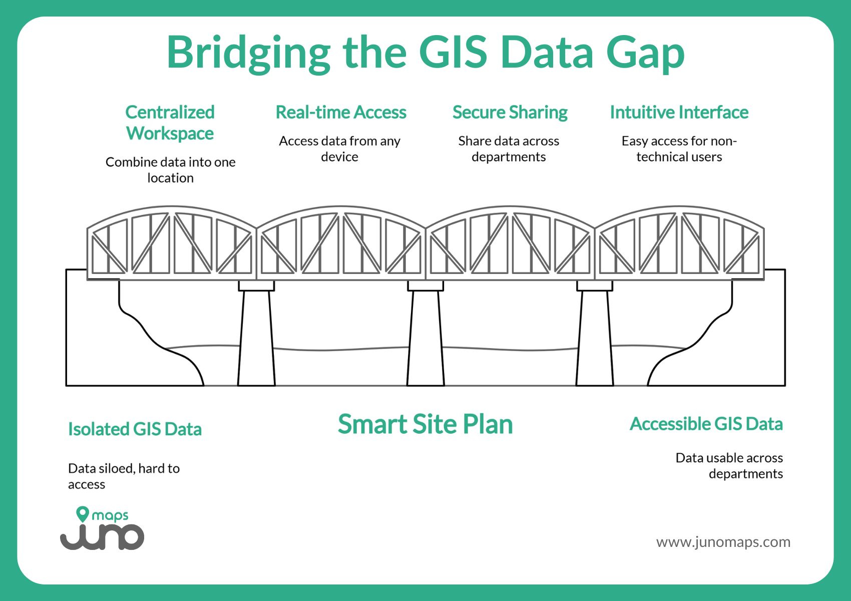
This is where Juno Maps’ Smart Site Plan fits naturally into the modern government GIS landscape.
Smart Site Plan is a cloud-based, geospatial software platform designed to make GIS data usable across local government departments, not just GIS professionals. It brings together GIS data, CAD files, PDFs, and open datasets into a single, location-based workspace that can be accessed in the office or the field.
With Smart Site Plan, governments can:
- Access GIS maps and project data in real time, from any internet-capable device
- Capture inspections, field observations, and documentation directly within a geospatial context
- Support secure data sharing across departments using a centralized map-based environment
- Use interactive maps to support planning, compliance, infrastructure maintenance, and disaster-related workflows
- Extend GIS access to non-technical users through an intuitive, mobile-ready interface
By connecting maps and data in a way that reflects real-world workflows, Smart Site Plan helps local governments make better decisions faster, while reducing rework, miscommunication, and reliance on paper plans.
At its core, Smart Site Plan is built to support how governments design, build, and maintain public infrastructure. By bringing CAD and GIS data into the field and enabling real-time collaboration, it improves site awareness, streamlines reporting, and helps teams work more safely and efficiently.
Whether used by public works staff, inspectors, planners, or emergency response teams, Smart Site Plan provides a practical bridge between traditional GIS systems and day-to-day government operations.
Smarter Decisions Start with Smarter Maps
GIS in government is no longer optional. It is a critical technology that helps governments plan smarter, respond faster, and serve communities better. When spatial data is accessible, integrated, and easy to use, decision-making improves at every level.
As governments face growing challenges, from infrastructure strain to climate risk, the ability to turn geospatial data into action will define successful public agencies. Tools like Juno Maps’ Smart Site Plan show what’s possible when GIS technology is built for real people, real workflows, and real-world decisions.
Smarter government starts with smarter maps, and GIS makes that possible. Get in touch to learn more!
Ready to Put This Into Practice?
See how Juno Maps applies to your specific industry and use case.