
GIS Tools Built for Every Phase of Emergency Management
Smart Site Plan gives county emergency managers, municipal planners, and public safety directors the geospatial infrastructure to plan for, respond to, and recover from natural hazards, fully aligned with FEMA Risk MAP and HMGP frameworks.
Effective Hazard Mitigation Starts with Authoritative Geospatial Data
Disaster resilience isn't built during a declared emergency, it is built in the months and years prior, through deliberate planning, complete asset inventories, and coordinated data sharing across agencies. Yet most local governments still manage hazard data in siloed spreadsheets, static PDFs, and fragmented GIS files that cannot support the speed or coordination a major event demands.
Smart Site Plan consolidates parcel records, infrastructure layers, FEMA hazard zones, social vulnerability indexes, and real-time field reports into a single, browser-based platform. No enterprise GIS license required, your planners, emergency managers, and elected officials all work from the same operational picture.
Full-Lifecycle Support Across Preparedness, Response, and Recovery
From pre-disaster hazard mitigation planning to post-event FEMA Public Assistance documentation, Smart Site Plan provides the geospatial tools your team needs, accessible to every department, not just GIS specialists.
Preparedness
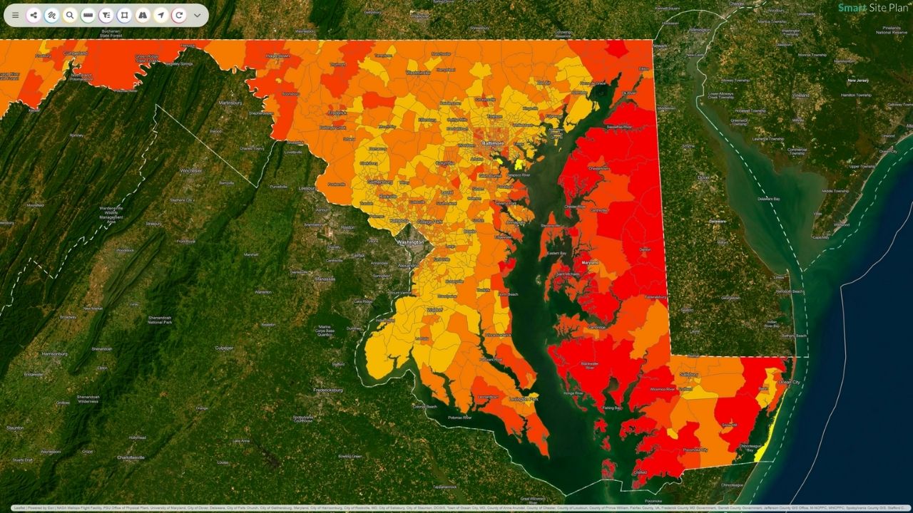
- Delineate multi-hazard exposure zones with integrated FEMA, NOAA, and USGS hazard layers
- Overlay CDC Social Vulnerability Index data to identify at-risk populations for prioritized outreach
- Document and maintain critical infrastructure inventories linked to parcel-level records
- Sketch structural and non-structural mitigation alternatives to support Local Hazard Mitigation Plans (LHMPs)
- Harmonize data from spreadsheets, CAD drawings, remote sensing, and real-time sensor feeds into a unified map
Response
- Query specific assets, populations, or geographic areas by complex criteria to support ICS/NIMS operational priorities
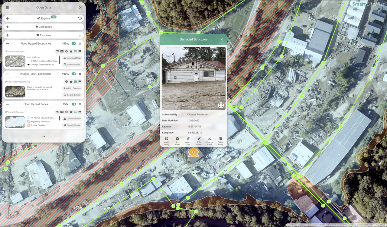
- Deploy mobile-first field reporting for damage assessment teams, geo-tagged photos, loss estimates, and needs assessments submitted directly from the field
- Enable cross-agency situational awareness with shared, property-linked maps accessible to EOC staff, mutual aid partners, and state liaison officers
Recovery
- Document parcel-level structural damage to support FEMA Public Assistance, Individual Assistance, and HUD CDBG-DR applications
- Generate georeferenced reports and loss maps to substantiate HMGP, BRIC, and philanthropic grant requests
- Monitor long-term community recovery benchmarks including housing redevelopment, utility restoration, and green infrastructure integration
- Archive event data and recovery records to accelerate future disaster declarations and strengthen institutional knowledge
Why County and State Agencies Choose Smart Site Plan
- Covers the full spectrum of natural hazards, wildfire, tornado, hurricane, flooding, coastal erosion, and sea-level rise, in a single procurement
- Aligned with federal frameworks including FEMA's Risk MAP program, HMGP/BRIC grant requirements, and HUD CDBG-DR reporting standards
- No GIS background required, an intuitive, sketch-based interface enables local officials, nonprofit partners, and community volunteers to create and update operational maps in real time
- Integrates parcel-level data, infrastructure system records, and historical hazard event data to help jurisdictions meet national risk management benchmarks and audit requirements
Risk MAP Aligned
Multi-Hazard
HMGP & BRIC Ready
Purpose-Built Tools for Every Declared Hazard Type
Each hazard module brings together authoritative federal data, local infrastructure records, and field-reporting tools, configured for the specific operational demands of that threat.


Technical Resources for Emergency Management Professionals
Guidance on hazard mitigation plan development, FEMA grant programs, GIS-based damage assessment, and post-disaster debris management for local and state agencies.
Strengthen Your Jurisdiction's Disaster Readiness
Speak with our team about how Smart Site Plan supports hazard mitigation planning, FEMA grant documentation, and multi-agency emergency coordination for counties, municipalities, and tribal governments.