Hurricane Preparedness and Coastal Resilience Planning
Smart Site Plan integrates NOAA storm surge models and FEMA coastal flood data with parcel records and critical infrastructure inventories, giving coastal utilities, port authorities, and municipal emergency managers a unified platform to prepare, respond, and recover.
Coastal Jurisdictions Require Authoritative Data to Protect Infrastructure and Save Lives
Hurricanes are the costliest category of federally declared disasters in the United States. Communities across the Gulf Coast, Southeast, and Atlantic seaboard face intensifying storms, accelerating sea-level rise, and compounding flood events that overwhelm aging coastal infrastructure and strain local government resources.
For coastal utilities, port authorities, and municipal governments, the operational challenge is acute: protecting interdependent critical infrastructure, maintaining continuity of essential services, and keeping residents safe, all while coordinating across multiple agencies with disconnected data systems and incompatible tools.
Smart Site Plan by Juno Maps resolves this by consolidating NOAA hurricane hazard data, FEMA coastal flood zones, infrastructure records, and community vulnerability layers into one browser-based platform, enabling coordinated, evidence-based decisions at every phase of the hurricane lifecycle.
Start Planning Today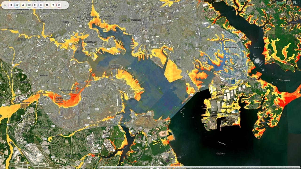
How Smart Site Plan Supports Hurricane Preparedness and Disaster Management
Integrated GIS tools for every phase of the hurricane lifecycle, from pre-storm continuity planning through long-term FEMA-documented recovery.
Hurricane Preparedness
- Map FEMA storm surge zones, Special Flood Hazard Areas, and wind hazard corridors using integrated NOAA and FEMA FIRM data layers.
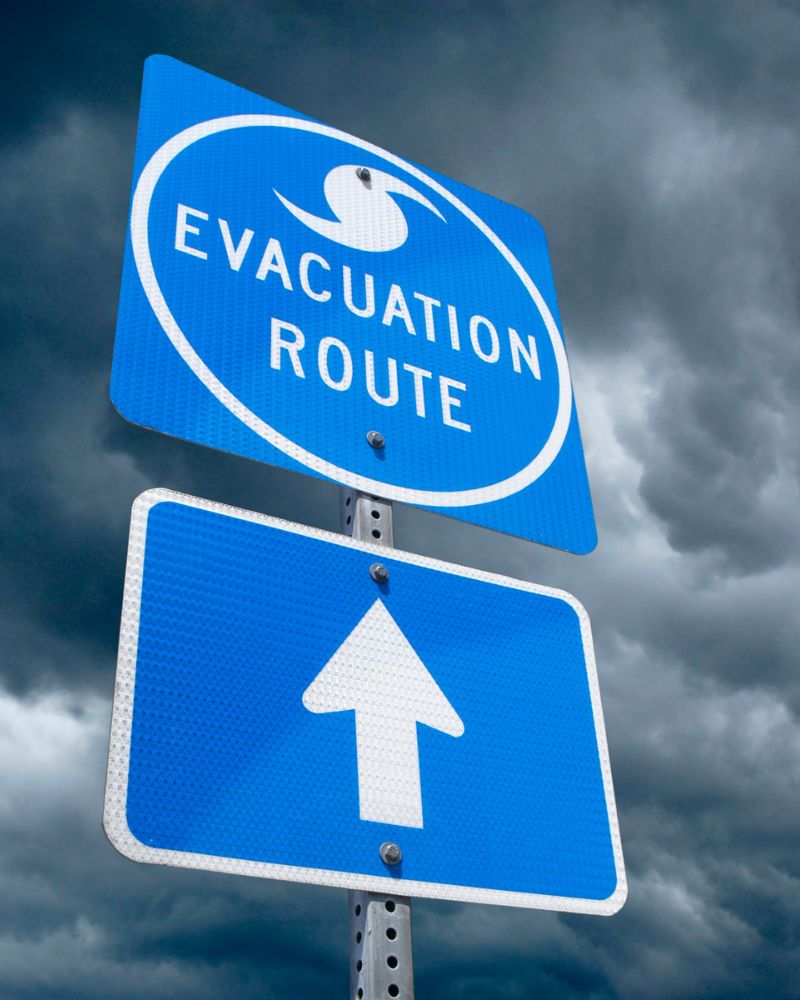
- Identify and document critical infrastructure at risk, ports, power substations, hospitals, water treatment facilities, and evacuation routes, with parcel-linked exposure analysis.
- Model evacuation scenarios and assess route accessibility under projected storm surge and compound flooding conditions.
- Maintain detailed asset inventories for utilities, port authorities, and municipal departments to support continuity of operations planning.
- Overlay CDC Social Vulnerability Index data to prioritize life-safety interventions for seniors, medically dependent residents, and low-income households.
- Document and track mitigation projects, seawalls, levees, elevated structures, stormwater upgrades, to support HMGP and BRIC grant applications.
Hurricane Response
- Publish evacuation orders, shelter-in-place zones, and shelter locations to residents and mutual aid partners through publicly accessible maps, no login required.
- Enable mobile field reporting for response crews: geo-tagged damage photos, utility outage logs, debris blockage locations, and road closure notifications.
- Integrate NOAA National Hurricane Center forecast tracks, storm surge predictions, and wind speed models for real-time EOC situational awareness.
- Equip utility response teams with parcel-linked outage maps and asset status layers to prioritize critical service restoration.
- Streamline ICS/NIMS-aligned coordination between emergency services, port authorities, utilities, and state emergency management agencies from a shared platform.
Hurricane Recovery
- Document parcel-level wind and flood damage to residential structures, commercial properties, ports, roads, and utility networks to substantiate FEMA Public Assistance declarations.
- Generate georeferenced damage reports and loss maps to support FEMA PA, Individual Assistance, HUD CDBG-DR grants, state recovery programs, and insurance claims.
- Track long-term resilience investments, facility elevation, stormwater system upgrades, utility hardening, coastal wetland restoration, against measurable recovery milestones.
- Archive hurricane response records, damage inventories, and recovery benchmarks to accelerate future federal disaster declarations and strengthen institutional readiness.
Why Coastal Agencies Choose Smart Site Plan
A single, accessible platform purpose-built for the organizations on the front lines of hurricane preparedness, response, and long-term coastal recovery.
Integrates NOAA NHC storm surge models, FEMA FIRM coastal panels, open federal datasets, parcel records, and critical infrastructure layers into a single operational platform.
Built for the specific needs of coastal municipalities, port authorities, utility operators, and homeowners associations in hurricane-prone regions.
No GIS license or specialist required, sketch-based tools and a browser-based interface accessible to planners, EOC coordinators, field crews, and elected officials.
Generates the documentation, maps, and reports needed for HMGP, BRIC, FEMA Public Assistance, and state coastal resilience grant compliance.
Reduces evacuation decision time, protects critical coastal infrastructure, and shortens post-storm recovery timelines for every jurisdiction it serves.
Hurricane Planning Technical Resources
Expert guidance on storm surge risk planning, coastal debris management, HMGP grant applications, and GIS-powered hurricane emergency response.
Strengthen Your Coastal Jurisdiction's Hurricane Readiness
Contact our team to learn how Smart Site Plan supports storm surge preparedness, ICS-aligned response coordination, HMGP documentation, and post-hurricane FEMA Public Assistance for coastal utilities, port authorities, and municipal governments.